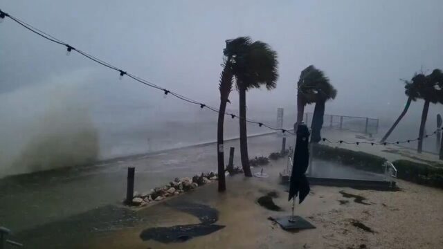
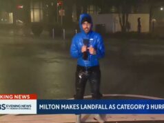
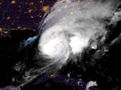
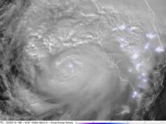
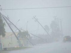
• Milton’s about to make landfall: Hurricane-force wind gusts are at the Florida coast with landfall expected within hours. The storm is just 35 miles from Sarasota. You can track Milton’s path with CNN’s storm tracker.
• Florida’s already feeling Milton’s effects: Milton could become one of the most destructive storms on record for Florida’s Gulf Coast. The storm’s prolific tornado outbreak already caused damage in the state earlier today. Water levels are also quickly rising as the hurricane’s powerful winds drive ocean water onto normally dry land.
• A monster storm: Hurricane Milton’s wind field has more than doubled in size since yesterday and it is expected to expand more. This means its disastrous impacts will be felt over a much larger area. Tropical-storm force winds are expected to cover the entire width of the Florida peninsula and stretch from Miami to Savannah by Thursday.
@tetovanews
“We don’t have to lose a life if folks just follow the instructions,” St. Petersburg mayor says
Massive piles of debris left over from Hurricane Helene should not be a concern as Milton approaches St. Petersburg – so long as residents heeded evacuation orders, Mayor Ken Welch told CNN’s Erin Burnett.
“We don’t have to lose a life if folks just follow instructions,” Welch said.
He added the city has a “high census” of residents in shelters and thanked those who have evacuated ahead of the storm.
Welch confirmed first responders have paused emergency services, something he does not take lightly.
“For the safety of our police, fire, and medical teams, they will not be able to respond to emergency calls until it is safe to operate,” city officials previously said on X.
In a video, first responders said 911 services will remain open and crews will resume operations when it is safe to do so.
The city has also taken two sewer treatment plants offline to protect workers from the potential storm surge of Hurricane Milton, officials announced.
As a result, residents and businesses are encouraged to limit water usage.
“Please avoid taking showers, doing laundry, or washing dishes as much as possible. Please flush toilets only as necessary as the toilet may not drain,” city officials explained.
Major flooding now occurring in Naples from Milton’s storm surge
Major flooding is now occurring in Naples as Milton’s storm surge causes water levels to rise to 3.7 feet above normally dry ground.
Just two weeks ago during Hurricane Helene, the storm surge in the area peaked at 4.02 feet even though the storm made landfall nearly 300 miles north of Naples, according to NOAA.
Fort Myers is also nearing 3 feet of water above normally dry ground. Both locations have increased by more than a foot in the last two hours.
Catastrophic flooding situation developing in Tampa Area
Extremely heavy rainfall across the Tampa area will continue and spread across Central Florida this evening, increasing the risk of life-threatening flash flooding.
“An axis of extreme rainfall, stretching from the Tampa metropolitan region northeastward into the north-central Florida Peninsula, is expected to result in major to locally catastrophic
flash flooding with considerable threats to life and property,” the Weather Prediction Center warned.
Over 6 inches of rain has already fallen in Tampa and the WPC is warning of an additional 5 to 8 inches in the next six hours. Rainfall rates could be as high as 2 to 3 inches an hour.
“Some locations could experience rainfall rates in excess of 1 inch per hour for 2-4 hours, causing rapid rises of water above the surface as water will not have sufficient time to drain, especially across the mostly impervious surfaces of the St. Petersburg into the Tampa metro and possibly nearing Orlando later tonight.”
“Floridians can rest assured” there will be a robust hurricane response, governor says
Florida Gov. Ron DeSantis said the state is well-prepared for Hurricane Milton thanks to federal and local support.
“Everything we’ve asked for, we’ve gotten. We’re working constructively with President Biden, we’ve marshalled all state agencies and we’re working very constructively with our local partners,” DeSantis told CBS News.
“We know what we’re doing here in Florida. We prepare for it. Floridians can rest assured: You’re going to have a very robust response. We’ve been ramping up for this,” he said.
DeSantis added his office is “working with FEMA to leverage resources,” and assured Floridians they will be allowed back into their homes once the storm passes.
NOAA hurricane hunter says he’s worried about destruction of Milton
A hurricane hunter with the National Oceanic and Atmospheric Administration (NOAA) who has been flying into Hurricane Milton said he is worried about the devastation the storm will bring to central Florida.
Nick Underwood, who has been collecting data from the eye of the storm all week, told CNN he has been helping his family and neighbors prepare in between flights. Underwood lives in St. Petersburg, one of the places that could be in the cone of Milton.
“I’m scared of what I’ll come home to.”
Underwood said.
Underwood said he has been a hurricane hunter for eight years. While every hurricane he flies through is different, he said Milton is a “powerful storm.”
“People who decided not to evacuate, now is the time to shelter in place. Now is the time to be as safe as you can,” he said.
The job of hurricane hunters are essential. While they are flying through a storm, they are collecting atmospheric and oceanographic data that feeds the National Hurricane Center’s forecasts and models, he said. This data is what the NHC uses to issue watches and warnings to people living in those areas.
“The better job we can do in the air, the most accurate those predictions are going to be and the earlier we can warn people that the storm’s coming their way,” Underwood said.
Most dangerous part of Milton now coming onshore
Milton has started the process of making landfall and its eyewall and most intense winds are coming onshore, according to the latest update from the National Hurricane Center.
Milton’s eyewall has winds screaming at 120 mph with higher gusts.
“The northern eyewall of Hurricane Milton is beginning to move onshore of the Florida gulf coast near Tampa and St. Petersburg where an Extreme Wind Warning is now in effect. Please shelter in place as these extremely dangerous hurricane-force winds overspread the region,” the center warned.
Remember: Landfall isn’t official until at least half of the hurricane’s eye crosses over land, likely within the next hour or two.
Rare “extreme wind warning” issued for entire Tampa Bay area
The Tampa area, which is bracing for Hurricane Milton’s impending landfall, is now under an extreme wind warning.
This type of warning is the most severe, most urgent alert for wind and indicates an “extremely dangerous and life-threatening situation.”
“TAKE COVER NOW! Treat these imminent extreme winds as if a tornado was approaching and move immediately to the safe room in your shelter,” the Tampa National Weather Service warned. “Take action now to protect your life!”
An extreme wind warning is in effect for Tampa FL, Saint Petersburg FL, Clearwater FL until 9:30 PM EDT for extremely dangerous hurricane winds. Treat these imminent extreme winds as if a tornado was approaching and move immediately to an interior room or shelter NOW! pic.twitter.com/ddbaAC1rhl
— NWS Tampa Bay (@NWSTampaBay) October 9, 2024
Insane! St. Petersburg currently. pic.twitter.com/jrvSDOSpmz
— Mike’s Weather Page (@tropicalupdate) October 9, 2024


