One veteran Florida meteorologist is warning people to watch out for how rapidly storm surge from Hurricane Milton could rise. Milton is expected to make landfall in the central part of the state soon.
John Morales, who is the longest-serving meteorologist in south Florida, said he has extensively studied the storm surge from Hurricane Ian.
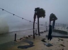
“The surge, it starts to come in slowly,” many hours before the hurricane hits land, he told CNN. “But then, suddenly it really starts to accelerate. The water levels start to rise so quickly and so shockingly that that’s when people really get caught off guard.”
In addition to storm surge, Milton will also bring extreme wind and flash flooding from heavy rain, the NBC 6 South Florida meteorologist said.
@tetovanews
Catastrophic flooding situation developing in Tampa area
Extremely heavy rainfall across the Tampa area will continue and spread across Central Florida this evening, increasing the risk of life-threatening flash flooding.
“An axis of extreme rainfall, stretching from the Tampa metropolitan region northeastward into the north-central Florida Peninsula, is expected to result in major to locally catastrophic flash flooding with considerable threats to life and property,” the Weather Prediction Center warned.
Over 6 inches of rain has already fallen in Tampa, and the WPC is warning of an additional 5 to 8 inches in the next six hours. Rainfall rates could be as high as 2 to 3 inches an hour.
“Some locations could experience rainfall rates in excess of 1 inch per hour for 2-4 hours, causing rapid rises of water above the surface as water will not have sufficient time to drain, especially across the mostly impervious surfaces of the St. Petersburg into the Tampa metro and possibly nearing Orlando later tonight.”
Hurricane Milton’s worst is arriving now in Florida
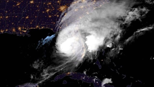
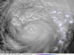
What Hurricane Milton looks like from space as it churns toward Florida
Six key things to know about Hurricane Milton
We’re due to hear from Florida Governor Ron DeSantis shortly but before then, here’s the latest on Hurricane Milton:
Milton, currently a category three storm with maximum sustained winds of 120mph (205km/h), is expected to make landfall in the next few hours near Tampa Bay – an area of roughly three million residents
Although it’s been downgraded from a category four, the second highest danger level, forecasters and officials agree that it remains a deadly threat
President Biden has warned people living in the storm’s path to evacuate: “Sometimes moving just a few miles can be the difference between life and death,” he said earlier in a White House statement
Millions of southern Florida residents are under mandatory orders to evacuate, though an unknown number have chosen to remain behind
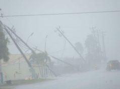
Storm surges have already begun to bring high water to coastal communities, and several tornados have been sparked, with more than 285,000 customers having already lost electricity in Florida, according to Poweroutage.us
There are concerns that debris from Hurricane Helene, which struck the same region less than two weeks ago, may become airborne due to high winds, creating added danger


