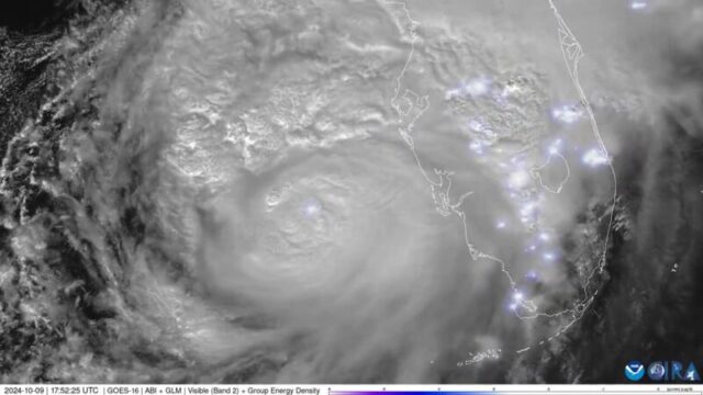
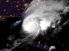
Satellite imagery is providing a view of Hurricane Milton from space as it churns closer to Florida.
NOAA’s GOES East satellite provides new images of Minton’s clouds every 30 seconds, the agency said. The GOES satellites — short for Geostationary Operational Environmental Satellites — are NOAA’s most sophisticated, according to its website. The agency posted a clip of imagery on X on Wednesday.
Frequent flashes of lighting are also visible in the video.
The satellite is orbiting more than 22,000 miles “above Earth’s equator, at speeds equal to the Earth’s rotation,” NOAA said, allowing it to stay over specific locations.
See the satellite imagery:
This imagery from @NOAA‘s #GOESEast ️ is providing visible cloud imagery every 30 seconds of #HurricaneMilton as it pushes closer to Florida. Notice the frequent #lightning being picked up by the satellite’s #GLM instrument as well.
Get the latest on #Milton:… https://t.co/33Yng1EYNC pic.twitter.com/5Xjb2K2Y49
— NOAA Satellites (@NOAASatellites) October 9, 2024
Heavy rain, strong winds and a prolific tornado outbreak are underway in Florida with worse conditions and life-threatening storm surge to come. Milton is expected to hit the central part of the state later tonight.
@tetovanews
#HurricaneMilton #Milton #Hurricane #HuracánMilton #Huracán #Florida #Tampa #StormMilton #tormentatropical #Hurrikan #Jahrhundertsturm
Hurricane Milton spawns tornadoes as it approaches Florida https://t.co/A0IGfg8wzF via @Tetova News— Tetova News (@TetovaNews1) October 9, 2024
#HurricaneMilton #Milton #Hurricane #HuracánMilton
#Huracán #Florida #Tampa #StormMilton #tormentatropical
Hurricane Milton’s storm surge begins on Florida Gulf Coast https://t.co/szV9HrVZFS via @Tetova News— Tetova News (@TetovaNews1) October 9, 2024


